Inheritance of the Transit: Why Nineteenth-Century Survey Decisions Still Price Your Capacity Project
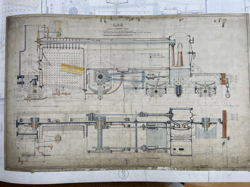
Photo: historic railroad survey map vintage engineering drawings, via www.gnrsociety.com
Every capacity project begins with a map. And on most American freight corridors, that map is not really yours.
It belongs to a survey party from the 1850s through the 1890s — men with a transit, a chain, and a deadline set by land grants and competitive urgency — who chose where the alignment would curve, where it would climb, and how wide the right-of-way would be. Those decisions were rational for their era. They were also permanent in ways that modern capital planning still struggles to price.
What the Original Survey Actually Locked In
A nineteenth-century locating engineer worked with three constraints we no longer face: labor was cheap, earthmoving was manual, and the objective was often simply to reach a destination before a rival railroad did. The result was alignment logic optimized for minimal excavation rather than optimal velocity.
Three artifacts of that era follow the steel today:
- Curvature. Degree-of-curve limits set for four-axle steam equipment routinely exceed what modern 286,000-pound freight cars prefer, forcing slow orders on tangents that could otherwise carry 50 mph running.
- Grade. Rulings of 1.0 to 1.8 percent, chosen to avoid expensive trestlework, now define helper districts and fuel penalties that compound across every train-year.
- Right-of-way width. A typical 100-foot grant leaves little room for second mains, passing sidings of modern length, or the drainage and signal infrastructure a capacity project demands.
None of these can be negotiated with the dead. They can only be engineered around — or engineered against.
A Representative Corridor: The Whitcomb Cutoff
Consider a corridor we will call the Whitcomb Sub — fictional in name, typical in every measurement. Built in 1873 across rolling terrain, it features a 12-degree horseshoe at Milepost 41, a 1.4 percent eastbound grade stretching nine miles, and a right-of-way pinched between a river and a state highway realigned in 1962.
The railroad's service plan calls for doubling clearances and raising through speeds. Preliminary engineering returns three options:
Option A: Work within the legacy alignment. Rebuild the curve to 8 degrees in place, add a 10,000-foot siding on the existing bench, and accept the grade. Estimated cost: $28 million. Capacity gain: roughly 22 percent.
Option B: Relocate the curve. A 3.5-mile realignment eases the horseshoe to 4 degrees and slices two miles off the profile. Estimated cost: $71 million — driven not by trackwork but by land acquisition, environmental permitting along the river, and a highway bridge replacement triggered by the new footprint.
Option C: Grade separation of the conflict. Keep the curve, but double-track around it with directional running, deferring the realignment indefinitely. Cost: $39 million, with the realignment decision pushed to a future board.
The arithmetic is instructive. Option B buys the best geometry, but roughly 60 percent of its cost is spent correcting the consequences of the 1873 survey — land, permits, and interfaces — not the track itself. Option A spends almost nothing on legacy correction and still captures most of the operational benefit.
The Rule the Numbers Keep Confirming
Across corridor studies, a pattern holds: the cost of fighting a legacy alignment is rarely in the earthwork. It is in the adjacency — the highway that has grown against the fence line, the wetland that now occupies the borrow pit, the substation built on the old staging ground. The survey party's cheap decision became someone else's expensive one, transferred through 150 years of land use that grew up around the steel.
A disciplined framework for the go/no-go on realignment:
- Price the adjacency first. Before modeling the new alignment, model the acquisition, utility relocation, and permitting. If those exceed 40 percent of project cost, the geometry rarely pays for itself.
- Quantify the slow order honestly. A permanent 25 mph restriction on a single curve costs real train-hours, but only at high densities does that exceed the amortized realignment premium.
- Stage the decision. Directional double-tracking and siding extensions can buy a decade of capacity while land options along the idealized alignment are quietly assembled.
- Respect the drainage. Legacy alignments follow legacy hydrology. Any new footprint inherits a century of upstream development the original engineer never imagined.
Honoring the Ghost
There is a temptation, in modern capital planning, to treat old alignments as obstacles. The better framing is that they are the most thoroughly field-tested design document in existence — selected by trial, error, and a century of floods, washouts, and tonnage. Where the geometry can be lived with, living with it is usually the economically rational act.
Where it cannot — where a single curve throttles an entire corridor's velocity — the realignment case is real, but it must be made on the full ledger: land, permits, and interfaces included, not just the track.
The surveyor's transit is long retired. Its bearings, however, are still signing off on your budget. Capacity planning that begins by reading them carefully — rather than assuming they can be overwritten — is planning that survives contact with the field.